Construction Aerial photography offers many benefits to your construction business. From planning to completion and the ability to visually document and monitor activities. Construction Aerial photography can ensure your job site is safe and streamline.
We provide a full range of photogrammetry services.
Orthophotos
Digital Elevation Models (DEM)
Digital Terrain Models (DTM)
Contour Maps
Volume Measurements
IA Aerial Photography geo-references custom vertical images for use in most Geographic Information Systems including the following.
Google Earth
ESRI ARCG’s
DeLorme XMap
Global Mapper
Image files can be a primary data layer or a layer on top of your primary map dataset. Available image file types include.
Geo – Tiff
Geo – JPEG
Mr Sid
.ECW
.IMG
.KMZ (Google Earth)
Image turn around time can be as fast as one day for geo-referenced stitched imagery or ortho-rectification.
Flight lines with high overlap are planned and flown capturing multiple high – resolution images, which are then processed by a cutting edge system, generating true orthophotos, digital elevation models and color 3D point clouds. All work done in USA, for quality control, security and privacy.
Capabilities Vertical Aerial Imagery
Our capabilities allow us to capture vertical imagery with resolutions ranging from ½ inch to 36 inches per pixel. We can capture both natural color (RGB), and near infrared simultaneously, and all of our vertical cameras are calibrated to allow orthophoto production
Image files can be a primary data layer or a layer on top of your primary map dataset. Available image file types include.
Spot Shots
Mosalced Imagery
Orthophotos
GIS (Geographic Information System) Datasets
This 3D model, in combination with existing survey data and aircraft GPS data, is used to create an accurate representation of the scene.
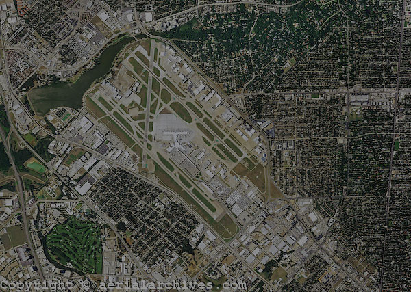
Ortho-photos are the foundation of maps used in Geographic information Systems (GIS) including Google Earth.
IA Aerial Photography accomplishes all of our ortho-photo production in-house, and can provide very fast run around times for most projects.
Vertical Aerial Photography
CONTACT US TODAY FOR YOUR PACKAGE QUOTE 850-251-4181